Umbrellas in hand! A weekend of rains and wind gusts in several provinces of the country.
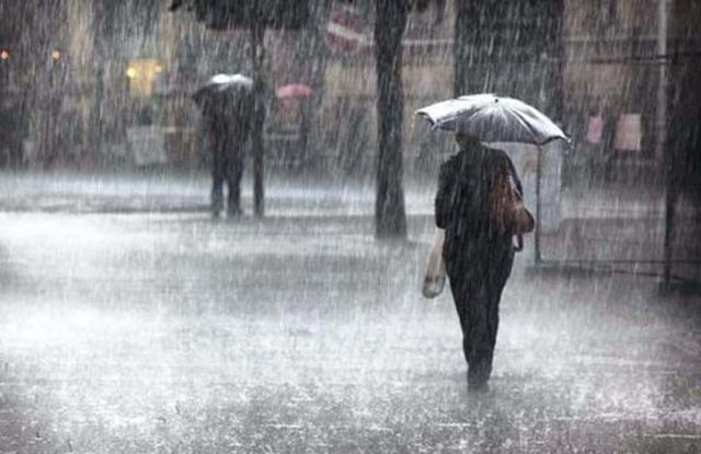
National District – This weekend, rains, thunderstorms, and wind gusts will mark the weather in different provinces due to the aftermath of a tropical wave combined with the influence of a trough.
This Saturday, although the central axis of the tropical wave will have left our forecast area, its cloud structure and residual humidity will still be present.
Added to the local effects of convection and orography, these factors will cause increased cloudiness, scattered showers of moderate intensity, thunderstorms, and wind gusts.
The most affected provinces will be Samaná, Sánchez Ramírez, Monseñor Nouel, Monte Plata, Hato Mayor, San Pedro de Macorís, La Vega, San Juan, the southern part of Santiago, and Elías Piña.
On Sunday, although humidity will decrease gradually, it will combine with a trough in the middle and upper levels of the troposphere.
This will favor the formation of clouds, followed by locally heavy downpours, thunderstorms, and wind gusts during the afternoon and early evening.
The most affected provinces will be Samaná, La Romana, San Pedro de Macorís, María Trinidad Sánchez, Duarte, La Vega, Santiago, Monseñor Nouel, San Juan, Elías Piña and Dajabón, as well as other areas in the northwest, north, southwest, the border area, and the Central Cordillera.
Given this situation, the National Institute of Meteorology (Indomet) maintains alert levels in several provinces due to the expected rainfall in the next 24 to 48 hours.
In addition, it warned of possible river, stream, and creek flooding, landslides, and urban flooding.