Rains create transit chaos in the capital
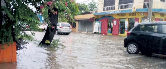
Greater Santo Domingo was affected by heavy downpours that occurred yesterday due to a trough. GLAUCO CARPET
Yesterday’s downpours in Greater Santo Domingo turned its main streets and avenues into a kind of trap, where thousands of vehicles were locked in huge blockages.
The traffic jams blocked hundreds of vehicles on the main roads of the National District. They were distributed throughout the province of Santo Domingo and inside some neighborhoods that were taken as shortcuts.
The chaos began around 4:00 in the afternoon when public employees began to leave their jobs, but an hour later, it was almost impossible to circulate.
A team of reporters from LISTÍN DIARIO toured the city and measured the situation of numerous roads. Still, on 27 de Febrero Avenue, specifically, the jam-up occupied both directions, east-west and vice versa, affecting its extension to the municipality of Santo Domingo West.
The enormous puddles of water that formed on 27 de Febrero Avenue, right on the corners of Caonabo Street, inside the tunnels, over the elevated ones, and in the extension at the entrance of Ureña Residential, were responsible for drivers taking more than three times the usual time to reach their homes.
In other wide avenues such as John F. Kennedy, Independencia, George Washington, Hermanas Mirabal, Nicolás de Ovando, Charles de Gaulle, and others of normally heavy traffic flows were quiet yesterday.
The lake that formed on 27 de Febrero, at the height of the Caonabo, limited the road to two lanes in a west-east direction. Vehicles that crossed seemed to be navigating on the water.
Forecasts and alerts
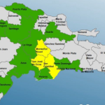
The National Office of Meteorology (ONAMET) reported that a frontal watercourse continues to produce downpours and electrical storms over several provinces of the country, so the Emergency Operations Center keeps the Great Santo Domingo, La Romana, San Cristobal, San Pedro de Macoris, Peravia, Monte Plata, Azua, Barahona, San Jose de Ocoa and Hato Mayor under green alert.
Also, Onamet keeps these locations under a weather alert for possible sudden or gradual urban flooding, as well as overflowing rivers, streams, and ravines.
In last night’s report, Onamet explained that cloudy fields loaded with humidity continue to produce locally moderate to heavy downpours at times, with electrical storms and occasional gusts of wind over much of the Dominican Republic, the result of the incidence of a pre-frontal flood and the cloud band remnants associated with Hurricane Eta.
Decreasing rains today
For today the Onamet informed that the prefrontal watercourse would move away from the country, expecting a reduction in the moisture content during the morning hours, without
However, during the afternoon, scattered downpours, thunderstorms, and isolated wind gusts are expected, with less intensity and frequency towards the northeast, southeast, southwest, and central mountain regions.


