Tropical wave and a trough will cause showers for the next 48 hours
The National Meteorology Office (ONAMET) predicts that the downpours will continue due to the incidence of a tropical wave that is passing over Haiti, a low-pressure north of the national territory, and a trough over the Wind Channel.
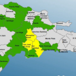
The downpours will be accompanied by thunderstorms and wind gusts towards provinces in the north, northeast, southeast, northwest, and the central mountain range.
“For the next 48 hours, although the tropical wave will be moving away from our area, a surface trough will continue to affect the country. Therefore, it is expected that mainly in the afternoon, there will be cloudy conditions that will produce occasionally heavy downpours, accompanied by electrical storms and gusts of wind, especially in towns belonging to the north, northeast, southeast, southwest regions, as well as the central mountain range and the border area,” explains Onamet.
In another order, Onamet monitors an area of disorganized downpours and electrical storms associated with low pressure, located a few hundred kilometers north of the country, with a 40% chance of reaching the category of a hurricane in the next 48 hours.
Finally, Hurricane Ofelia is reported to have become a post-tropical cyclone. Due to its position and trajectory, this phenomenon does not pose a danger to the Dominican Republic.
Local forecasts
Today the sky will be cloudy with occasionally heavy downpours, thunderstorms, and gusts of wind towards the north, northeast, southeast, northwest, and the central mountain range.
In the National District and the Santo Domingo province, the sky will be cloudy to cloudy with showers, thunderstorms, and gusts of wind in the morning and afternoon. The maximum temperatures will be between 31ºC and 32ºC (88-90°F) and the minimum between 22ºC and 23ºC (71-73).