UPDATE: COE increases to 17 provinces on green alert for trough
Today, the Emergency Operations Center (COE) increased provinces on green alert for possible floods of rivers, streams and ravines, as well as flash or urban floods to 17, due to a trough at various levels of the troposphere and the distance of the tropical wave southwest of Haiti or the channel of the Winds.
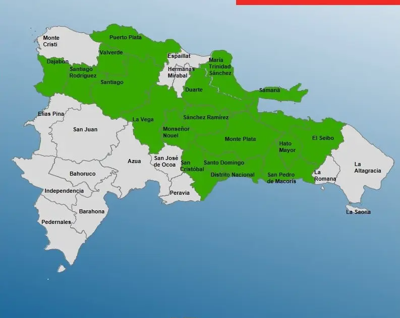
According to the entity, among them are: La Vega, Monte Plata, El Seibo, Monseñor Nouel, Hato Mayor, Puerto Plata, Dajabón, Santiago Rodríguez, Valverde, Duarte (especially Bajo Yuna), Sánchez Ramírez, Santiago and Samaná.
For its part, the National Meteorological Office (ONAMET) forecast for today moderate to heavy rains, thunderstorms and wind gusts towards the Northeast, Southeast, North, the Central mountain range and border area.
The agency said those conditions will be caused by a tropical wave combined with the effects of a trough at altitude.
It added that Tropical Storm Nicholas was located this morning, about 75 km southeast of Boca del Rio Grande. “It poses no danger to the Dom Rep.”
- A tropical wave is forecast to emerge from the western part of Africa for the next 48 hours with one (20%) becoming a tropical cyclone and 70% over the next 5 days.
- An area of downpours with thunderstorm, associated with an area of non-tropical low pressure in the extreme northeast of the Atlantic has a low probability of 0% in 48 hours to become a tropical cyclone.
- A low pressure area north of the Bahamas has (0%) to become a tropical cyclone in 48 hours and 50% over the next 5 days.