Trough continues to disrupt local conditions; 14 provinces reduced to 14 on alert
Santo Domingo, DR
Today, the trough will continue to cause downpours, thunderstorms, and wind gusts in different sectors of the north, northeast, southeast, Central Cordillera, and border area. In addition, temperatures will remain hot, and the wind will blow from the east/southeast.
This is stated in the National Meteorological Office (ONAMET) bulletin, which indicates that 14 provinces remain on alert for possible flash floods of rivers, streams, and creeks due to the recorded and forecast rains well as urban floods and landslides.
The provinces on alert are Monte Plata, María Trinidad Sánchez, Puerto Plata, La Vega, Sánchez Ramírez, Santiago, Monseñor Nouel, Santiago Rodríguez, Hato Mayor, Dajabón, Samaná, Duarte, Valverde and El Seibo.
“For Wednesday and Thursday, the trough will continue to influence conditions in the Dominican Republic, in addition a new tropical wave will be added and both will be generating afternoon cloud increases with rains that could be moderate to heavy, thunderstorms and wind gusts distributed in the regions: east, northeast, southeast, north, the Central Cordillera and the border area.”
Other phenomena
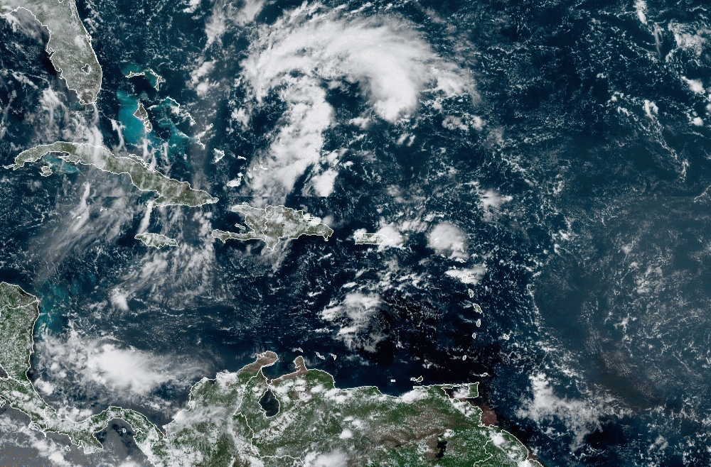
Onamet reports that tropical storm Nicholas is located about 50 kilometers south/southwest of Houston, Texas. (It offers no danger to the country).
“We’re monitoring an area of low pressure located over the Bahamas and northeast of the Dominican Republic with 30% of increasing intensity in the next 48 hours and 60% in 5 days.
Additionally, a tropical wave west of Africa’s coast, with a medium percentage (50%) of becoming a tropical cyclone in 48 hours and increasing to 80% in 5 days.