Dust from the Sahara and tropical wave bring complex weather to the Dominican Republic
Meteorological analyst Jean Suriel reported this past Tuesday that Saharan dust particles are in the Dominican Republic, making the sky slightly hazy and the atmosphere hot: today, the hot wind convection effect will be high in much of the country. At the same time, allergic processes will be present in the next 48 hours.
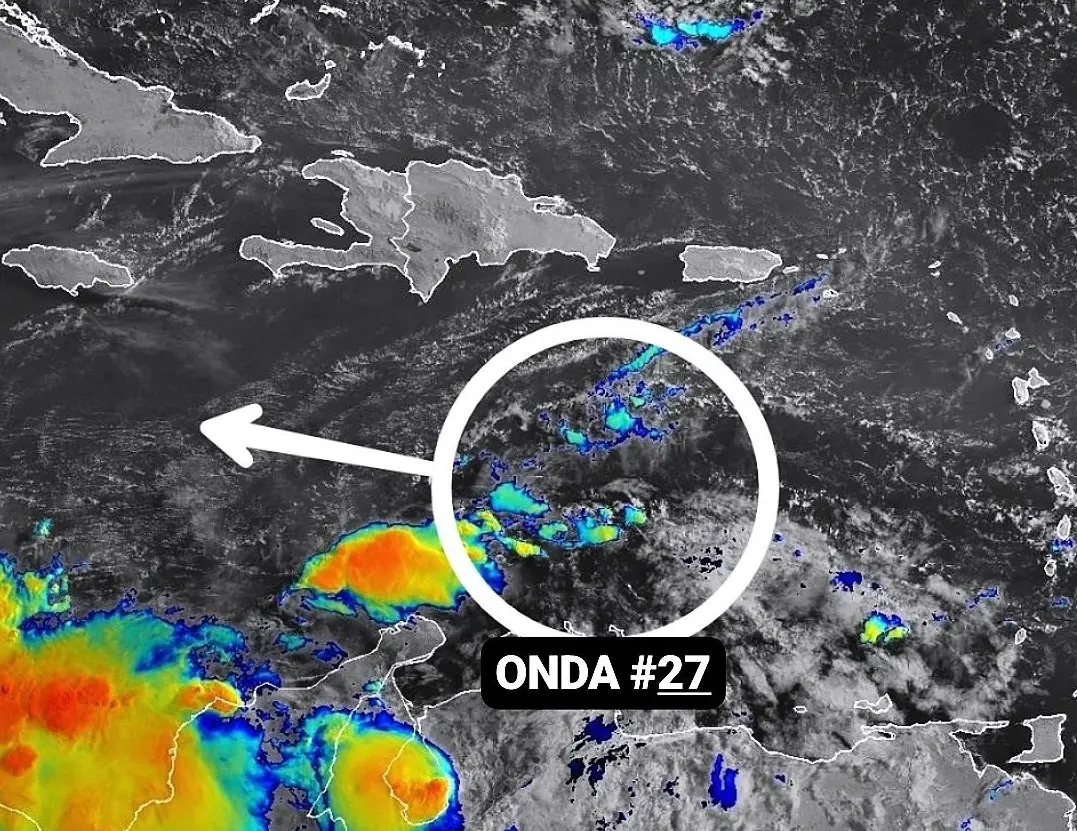
“Today we will have the fight between the Saharan dust and tropical wave number 27, which is transiting in the waters of the Caribbean Sea: at the end of the afternoon some showers could develop in the southeast, northeast, south, Central Cordillera, northwest and border area. Without ruling out showers in northern areas,” he explained.
The analyst also mentioned that on Wednesday, the African particles diminished, allowing the wave to have more significant effects on the country: heavier rains towards the northwest, north, Central Cordillera, and border area and moderate rains towards the south and northeast.
However, he noted that more dust from the Sahara would return to the Dominican territory on Thursday and Friday. The humid winds coming from the marine region could have an impact, with some showers in the afternoon and night in the border area, northwest, Central Cordillera, and south.
“For Saturday, the arrival of tropical wave number 28 to the country is expected: due to its presence in the region, we will have more probabilities of moderate to heavy rainfall after noon,” he assured.
“The most persistent meteorological element in the coming days, will be the high temperatures because we are in summer and we are approaching the hottest period of the year in the DR,” he concluded.