Tropical Storm Franklin: Alerts and updates

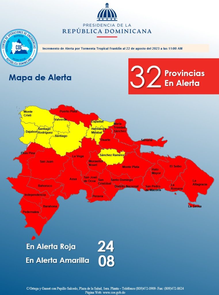
Santo Domingo.- The Emergency Operations Center (COE) has elevated the number of areas under red alert to 24, and those under yellow alert to eight, in response to the impending arrival of tropical storm Franklin in the Dominican Republic. The storm is currently situated at a latitude of 14.6 north and longitude 70.6 west, approximately 410 km south of Santo Domingo.
The COE has issued a tropical storm warning extending from Saona Island to the border with Haiti (Pedernales). Additionally, tropical storm conditions are expected from Saona Island to Montecristi.
The National Meteorological Office (Onamet) has reported that the maximum sustained winds of the storm remain at 85 kph, accompanied by higher gusts. The storm’s winds extend to about 110 km from its center, while it is moving in a westward direction at around 5 kph.
The impact of Tropical Storm Franklin is predicted to be felt directly in the Dominican Republic on Wednesday morning, bringing heavy and frequent downpours, lightning storms, and powerful wind gusts across various provinces. Among the provinces at high risk are La Altagracia, El Seibo, Hato Mayor, Monte Plata, Sánchez Ramírez, Monseñor Nouel, La Vega, Santiago, La Romana, San Pedro de Macorís, Greater Santo Domingo, San Cristóbal, Peravia, Azua, Barahona, Pedernales, San Juan, Independencia, Bahoruco, and Elías Piña.
The maritime conditions have been deteriorating progressively, leading to a recommendation for operators of fragile, small, and medium-sized vessels to remain in port due to strong winds and abnormal waves.
In addition to Tropical Storm Franklin, other weather phenomena are being monitored by Onamet. Tropical Depression Gert is situated approximately 470 kilometers east/southeast of the Leeward Islands, with sustained winds of 45 kph, moving west/northwest at 13 km/h. The monitoring also extends to Tropical Storm Harold, located about 245 kilometers east/southeast of Mansfield, Texas, with maximum sustained winds of up to 75 km/h, moving rapidly to the west/northwest at 30 km/h. Additionally, there are two areas of downpours and thunderstorms associated with a tropical wave, although the probability of them evolving into tropical cyclones in the next 48 hours is low.


