
Rainfall will decrease across the country starting this Saturday


Santo Domingo — The tropical wave and trough that have caused rain across the country will no longer directly affect the Dominican Republic; only remnants remain, producing rain in the interior.
According to meteorologist Cristopher Lorian of the Dominican Institute of Meteorology (Indomet), rain with thunderstorms and gusts of wind is affecting areas such as Santiago Rodríguez, the southern part of Santiago, and the mountainous areas in the locality of La Vega.
The meteorologist added that these rains are expected to move to other locations in the Cibao region during the afternoon, including Puerto Plata, Valverde, Dajabón, and our surrounding areas.
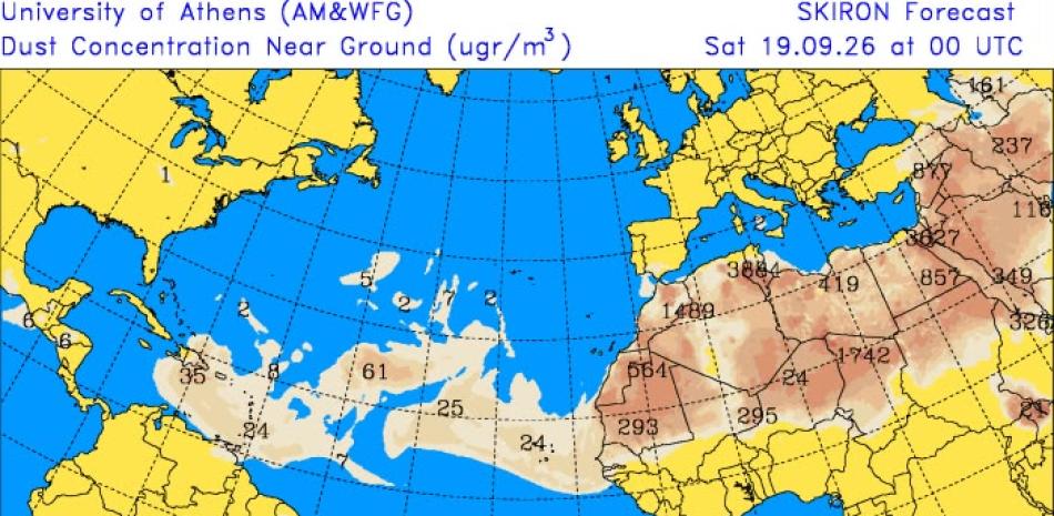
This Saturday, the country will continue to experience a humid air mass, with Saharan dust particles present at moderate concentrations and the influence of an anticyclonic system. These three factors will contribute to limited rainfall in terms of both quantity and spatial distribution.
“It will rain in fewer provinces, and what rain there is will be in smaller amounts. The skies will be mostly sunny and have a grayish appearance due to the Saharan dust particles that will begin to arrive tomorrow,” the meteorologist added.
Because of this, temperatures will feel hotter,r and the heat index will be even higher throughout the Dominican Republic.
For Sunday, conditions will be similar to those on Saturday, as will on Monday and Tuesday; although a trough will affect these days, the amount of humidity in the atmosphere will be much lower.