
Jean Suriel warns of increased rainfall and flash-flood risk in Dominican Republic


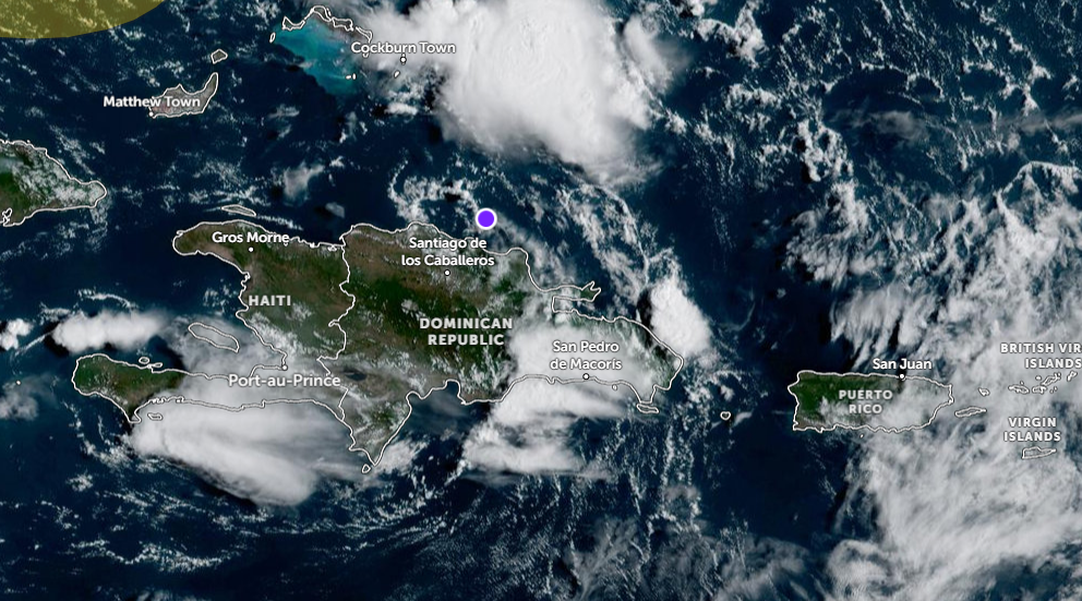
Santo Domingo.- The center of an atmospheric disturbance is currently located north of the Dominican Republic and moving west-northwest, a situation that will lead to increased rainfall, wind gusts and thunderstorms over the next 6 to 12 hours, according to meteorologist Jean Suriel.
Suriel warned that the potential for flash flooding will increase this afternoon, particularly in vulnerable areas and urban communities where heavy rainfall could cause rapid water accumulation.
Moderate to heavy showers, accompanied by wind gusts and thunderstorms, could develop across much of the Dominican Republic this afternoon and tonight. Urban flooding is possible in parts of the Cibao, southern and southeastern regions.
The meteorologist also reported that four atmospheric systems are currently being monitored across the Atlantic basin, two of which have the potential to develop into tropical systems in the coming days.
The systems include a disturbance over the Gulf of Mexico, which could become a tropical depression; the disturbance north of the Dominican Republic associated with the active Tropical Wave 43; Tropical Wave 45, currently over the central Atlantic and expected to reach the region on Thursday; and Tropical Wave 46 in the eastern Atlantic, which could approach the region on Sunday.
Given these conditions, Suriel urged residents to remain attentive to weather updates over the coming hours, particularly in areas vulnerable to flash flooding, as rainfall activity is expected to increase.