
Several earthquakes recorded in the Dominican Republic this Sunday


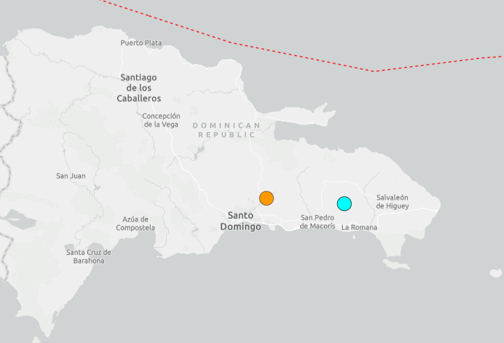
Santo Domingo.- Several earthquakes were recorded in the Dominican Republic this Sunday, September 27, with the strongest reported event occurring near the eastern part of the country, according to available seismic data.
One of the earthquakes was recorded at approximately 6:06 a.m. local time near Bayaguana, Monte Plata, according to the U.S. Geological Survey (USGS). The USGS reported a magnitude of 4.2, with the epicenter located about 13 kilometers (8 miles) south-southwest of Bayaguana.
The same morning, the National Seismology Center of the Autonomous University of Santo Domingo (UASD) reported a magnitude 4.3 earthquake near San Antonio de Guerra, Santo Domingo province. The earthquake occurred at a depth of approximately 95.7 kilometers and was felt in several areas of Greater Santo Domingo.
Reports indicated that the morning earthquake was also perceived in provinces including Monte Plata, San Cristóbal, San Pedro de Macorís, Hato Mayor, Sánchez Ramírez, Monseñor Nouel and El Seibo. No deaths, injuries or structural damage had been reported in connection with the event at the time of the reports.
Later in the day, earthquake-monitoring data reported another, stronger event in the eastern Dominican Republic. Volcanodiscovery, citing seismic data, reported a magnitude 5.2 earthquake approximately 8 kilometers southeast of Ramón Santana, in the San Pedro de Macorís area, at about 5:49 p.m. Dominican Republic time.
As of the latest available reports reviewed for this article, there were no confirmed reports of significant damage or casualties associated with Sunday’s earthquakes.
The Dominican Republic is located in a seismically active region of the Caribbean, where several tectonic structures contribute to earthquake activity. Authorities and seismological institutions routinely monitor these events and update their measurements as new data become available.