ONAMET foresees few rains due to the incidence of Sahara Dust over Dominican Republic
The dust from the Sahara arrives loaded with biological compounds.
Santo Domingo.-The National Meteorology Office (ONAMET) reported that the incidence of an air mass with low moisture content associated with the prevalence of dust particles from the Sahara desert would keep the probability of significant rainfall low over a substantial part of the country today.
However, the office indicated that as a result of the dragging of cloudiness that the east/northeast wind will be contributing, some occasional clouds with isolated showers are expected this afternoon.
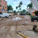
The precipitations will be frequent towards the localities of the Southeast region, the central mountain range, and some Greater Santo Domingo points, especially in the afternoon.
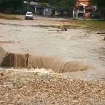
The agency predicts that for tomorrow, Monday, the approach of a tropical wave will be slightly increasing rainfall activity to cause some local downpours with isolated thunderstorms towards sectors of the Northeast, Southeast, Central mountain range, and Greater Santo Domingo.
Onamet is monitoring the activity of showers and thunderstorms associated with a tropical wave, located a few hundred miles south of the island of Cape Verde, which has a low percentage of 20% to become a tropical cyclone in the next 48 hours.
The entire population’s recommendation is maintained, avoid prolonged exposure to solar radiation from the hours of 11:00 in the morning to 4:00 in the afternoon.
Also, drink enough fluids and wear light clothes, preferably bright colors due to the high temperatures.
Meteorology urged citizens to adopt measures that allow the rational use of water, due to a rainfall deficit that has affected the country for several months.