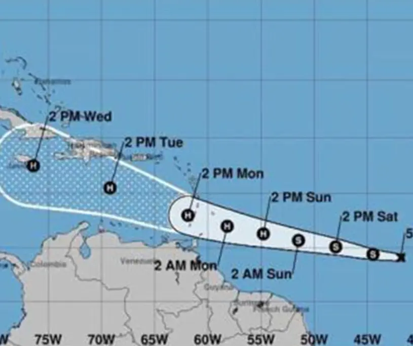
Storm update: Tropical Depression No. 2 forms; country should be on alert

Santo Domingo – Tropical depression number two of the 2024 hurricane season has formed and is approaching the Lesser Antilles with strong wind gusts of 55 kilometers per hour, moving 1,970 kilometers east of Barbados.
According to a bulletin issued by the National Meteorological Office (Onamet), the tropical depression could register rapid movements towards the West-Northeast in the next two days, and rainfall between 75 and 125 millimeters would be registered over the Lesser Antilles.
He urged the Dominican population to be attentive to the evolution of this tropical phenomenon, which, because of its position and trajectory, represented a danger for the country until last night.
Onamet forecasts that today there will be downpours and thundershowers in localities of the Northeast, Southeast, Central Cordillera, and the border area, being more intense over La Altagracia, El Seibo, Hato Mayor, Monte Plata, Sanchez Ramirez, Duarte, La Vega, San Juan and Elias Piña, among others.
For tomorrow, Sunday, downpours, thunderstorms, and wind gusts are also forecast for the Caribbean coast, the Northeast, the Central Mountain Range, and the border area.
Onamet is also monitoring two areas of downpours with thunderstorms associated with a tropical wave: one to the west/southwest of the Caribbean Cape Verde Islands, which has a low probability of becoming a tropical cyclone in the coming days, and the other to the southwest of the Gulf of Mexico, which has a 30% chance of reaching tropical cyclone status in the coming days.
Due to their position and displacement, neither of the two systems yet poses a danger to the Dominican Republic.
Temperatures are expected to remain hot due to the time of the year and the dust from the Sahara over the country.
The population is advised to drink fluids, wear light colored clothes and not to expose themselves to the sun.


