Vaguada (atmospheric moisture trough) and tropical wave leave but rains continue today
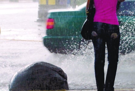
The trough of moist air and the tropical wave that affected the country left the territory and the latter travels to the eastern part of Cuba but left showers with gusts of wind and thunderstorms in the northeast, southeast and the Central mountain range, which will continue until tomorrow (Saturday).
The National Office of Meteorology (Onamet) predicted yesterday that the weather will be unstable and humid and forecasts for today weak rains in the afternoon until Saturday. Downpours were recorded yesterday over much of the country.
Onamet indicated that the temperatures will be high, ranging between 31º C and 33º C (88°F to 91°F) the maximum and between 24º C and 26 ºC (75°F to 79°F) the minimum.
The office recommends drinking enough fluids, wearing light clothes with light colors and having an umbrella on hand for some occasional downpours.
The report indicates that there are no maritime restrictions for vessels.
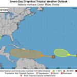
A few days after the end of the cyclonic season, Onamet does not foresee the formation of any atmospheric phenomenon that represents danger.
The entity reported an area of showers and thunderstorms associated with a low-pressure system in Campeche Bay, Mexico, with a 60% average chance of becoming a tropical cyclone in the coming days. Because of its position, it does not represent a danger to the country.