Active watch: Tropical wave could become a cyclone
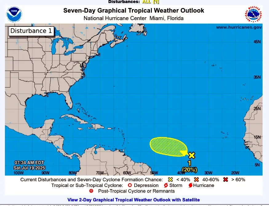
The National Institute of Meteorology (Indomet) reported that a tropical wave interacting with a low-pressure area located over the central Atlantic is being monitored.
According to Gloria Ceballos, the director of the entity, this system has a 10% chance of developing into a tropical cyclone within the next 48 hours and a 20% chance of becoming a tropical cyclone within the next seven days.
Rain and thunderstorms

Regarding local weather conditions for today, July 19, Indomet warns that wind-driven cloudiness could generate isolated showers in the morning hours, mainly over the provinces of La Altagracia, Samaná, and María Trinidad Sánchez.
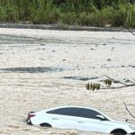
During the afternoon, a trough in the middle levels of the atmosphere will favor heavy downpours in isolated places, accompanied by thunderstorms and gusts of wind, over localities such as San Pedro de Macorís, El Seibo, Hato Mayor, Monte Plata, Sánchez Ramírez, San Cristóbal, Santo Domingo, La Vega, Azua, San Juan, Elías Piña, Independencia, Bahoruco, and Greater Santo Domingo.
As night falls, these precipitations will gradually decrease, leaving partly cloudy skies across much of the country.

Persistent heat and Sahara dust
The temperature will continue to feel quite warm due to the time of year and the presence of Saharan dust in the atmosphere. It is recommended to drink plenty of water, wear light-colored clothing, and avoid prolonged sun exposure, especially between 11:00 a.m. and 4:00 p.m.
Indomet reminds us that children and older people are especially vulnerable to extreme heat, so they should take extra precautions.