Powerful hurricane Erin reaches category 5
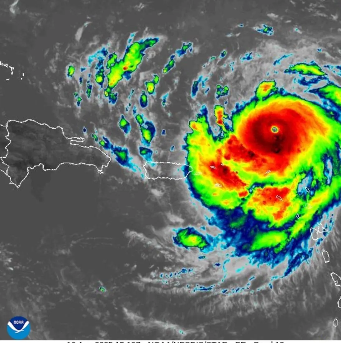
The director of the Dominican Institute of Meteorology (Indomet), Gloria Ceballos, informed this Saturday that hurricane Erin has intensified to become a powerful and catastrophic phenomenon, reaching category 5 on the Saffir-Simpson scale.
Ceballos detailed that Erin maintains maximum sustained winds of 255 kilometers per hour and is moving westward at 28 km/h and is expected to maintain this trajectory during the weekend, with a slight decrease in its translation speed.
According to Indomet’s most recent 11:00 a.m. bulletin, the center of Hurricane Erin was located near latitude 19.7 north and longitude 62.8 west, about 170 km north of Anguilla.
In its 6:00 a.m. weather report, the agency had informed that clouds are expected for today that will discharge heavy downpours, thunderstorms and gusty winds at times, starting in provinces such as: La Altagracia, Hato Mayor, La Romana, El Seibo, San Pedro de Macoris, Monte Plata, Samana, Sanchez Ramirez, Duarte, Maria Trinidad Sanchez, and Greater Santo Domingo.

It further specified that as this system continues to move towards the west/northwest to the northeast of our territory, these conditions will continue over these areas, and will also be moving towards other provinces during the afternoon and evening hours, such as: San Cristobal, San Jose de Ocoa, La Vega, Monseñor Nouel, Santiago, Hermanas Mirabal, Puerto Plata, Monte Cristi, Dajabón, Elías, Piña, Santiago Rodríguez, Valverde, Azua, and San Juan.
The COE
The Emergency Operations Center yesterday declared the provinces of La Altagracia, Hato Mayor, Espaillat, Montecristi, El Seibo, Samana, Maria Trinidad Sanchez, and Puerto Plata on green alert.
An update was expected at noon due to the intensification of Erin.