Saharan dust will continue to cause heat and little rain this Sunday.
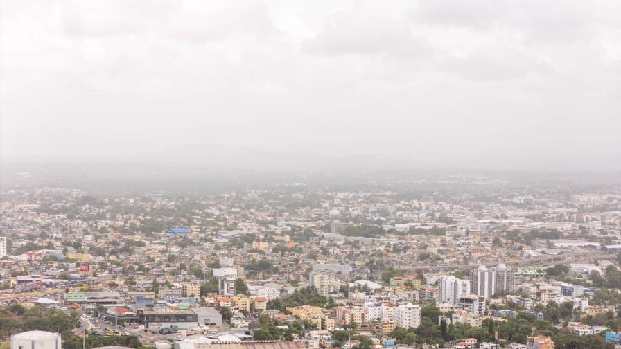
The sky looks cloudy when Saharan dust is present. Dominican Republic weather: hot temperatures are expected. ( DIARIO LIBRE/NEAL CRUZ )
Santo Domingo — The maximum temperature is expected to be between 33 and 35 °C
Weather conditions in the country will continue to be affected by Saharan dust, resulting in gray skies and warmer-than-usual temperatures, the Dominican Meteorological Institute (Indomet) reported on Sunday.
For the early hours of the morning, light rainfall is expected in much of the country, except for the provinces of La Altagracia, Samaná, El Seibo, and Hato Mayor.
For the afternoon and early evening, a low-lying trough in the troposphere, combined with the local effects of daytime warming, will bring localized showers, thunderstorms, and gusty winds to provinces such as Monte Plata, Monseñor Nouel, La Vega, Santiago, Santiago Rodríguez, Dajabón, San Juan, San José de Ocoa, Azua, Independencia, Bahoruco, Pedernales, and Elías Piña.
High temperatures and recommendations
Indomet reported that high temperatures will persist due to the time of year, the presence of Saharan dust particles, and the presence of an anticyclonic system. The minimum temperature is expected to range from 21 to 23°C, and the maximum from 33 to 35°C.
Given this, meteorological authorities recommend that the population :
- Avoid direct sun exposure between 11:00 am and 4:00 pm
- Drink plenty of water
- Wear lightweight, cool, light-colored clothing
Conditions for this Monday
Indomet warned that a tropical wave is expected to move south of the country on Monday, which, combined with easterly/northeasterly winds, will generate showers and possible thunderstorms starting this morning in La Altagracia, Hato Mayor, El Seibo, La Romana, María Trinidad Sánchez, San Pedro de Macorís, Santo Domingo, and Peravia.
In the afternoon, the combined effect of the trough in the troposphere will cause a new increase in cloudiness, with the potential for downpours, thunderstorms, and wind gusts in the northwest, the Central Mountain Range, and border areas.