Indomet is closely monitoring a tropical wave that could become a cyclone.
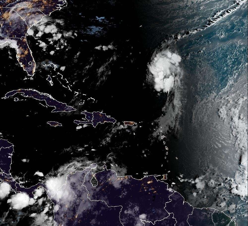
The Dominican Institute of Meteorology (Indomet) reported on Friday that it is monitoring an active tropical wave that could develop into a cyclone in the coming days.
The agency detailed that the phenomenon is located near the west coast of Africa and is producing disorganized downpours and thunderstorms.
During the weekend and early next week, environmental conditions could favor the gradual development of this system. It has a very low probability of reaching tropical cyclone status in the next 48 hours, but a 40% probability of reaching tropical cyclone status in the next 7 days.
“Due to its geographical location, we are closely monitoring it and recommend staying tuned for our upcoming newsletters,” Indomet noted.
Meanwhile, this Friday, the weather will be dominated by rain, especially in the towns of La Altagracia, La Romana, and San Pedro de Macorís, due to the east/southeast winds.
During the afternoon, a high-altitude trough will add to the daytime warming and the interaction of wind with the terrain, causing showers, thunderstorms, and gusty winds.
The most affected areas will be El Seibo, Hato Mayor, Monte Plata, Sánchez Ramírez, San José de Ocoa, Monseñor Nouel, Pedernales, Independencia, San Juan, Santiago Rodríguez, Dajabón, and Puerto Plata, with moderate to strong winds over the north of Azua, La Vega, Santiago, and Elías Piña, gradually decreasing at dusk. At the same time, the rest of the country will have few clouds and slightly grayish skies due to a slight concentration of Saharan dust.