Tropical Depression 10 is formed
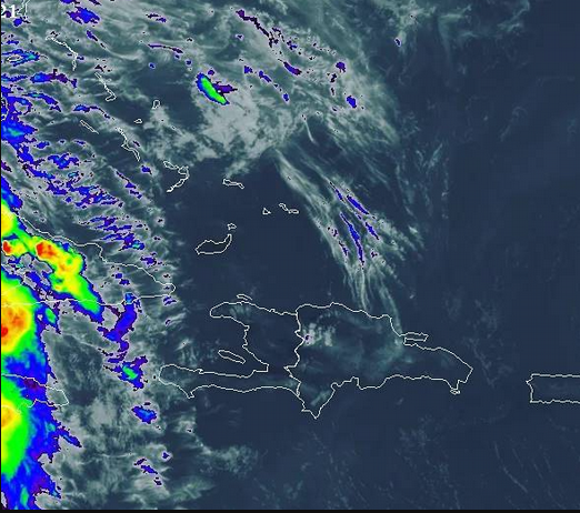
SUNNY, HOT ENVIRONMENT AND LITTLE RAINFALL OVER THE COUNTRY
Santo Domingo, DR
Early this morning, tropical depression No. 10 developed over the tropical Atlantic Ocean. The phenomenon is located about 1,300 kilometers (807 miles) east of the Leeward Islands, with maximum sustained winds of 55 kilometers per hour (34 mph).
According to the bulletin of the National Meteorological Office, the tropical depression is moving towards the north/northwest at about 11 kilometers per hour, and due to its location and displacement, it does not offer danger for the Dominican Republic.
As for the local forecast, ONAMET indicates that the weather will be dominated by hot temperatures, little rain, and lots of sunshine, caused by the effects of an air mass of low humidity and Saharan dust over our territory.
However, in the afternoon, there will be isolated showers and possible thundershowers in some areas of the north, northeast, and the Central Cordillera due to the passage of a weak tropical wave.
Onamet is also monitoring an area of showers and thunderstorms associated with areas of low pressure, located several hundred kilometers east of Bermuda, which has a 40% chance of becoming a tropical cyclone.
Local forecast
For Santo Domingo and the National District, there will be scattered clouds with maximum temperatures between 32ºC and 34ºC (89°F-93°F) and minimum temperatures between 22ºC and 24ºC (72°F-75°F).